Matzen
Trip overview
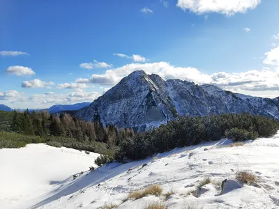
Matzen lies beyond the main range of Karavanke and with its height it is not the primary goal for anyone visiting this mountain range. Yet it’s definitely a really cool mountain with medium length ascent, relatively mild slopes, rewarding views and bit of scrambling at the end. Its main ridge lies in north-southern direction. Matzen has 4 peaks, all of them can be visited.
Starting from Ferlach Dollich first we need to cross the Waidischer Bach using the available bridge. We leave the riverbed and start the ascent just behind a forest road block. First 350 meters of ascent run through the forest and are mildly steep with exception for one section. After that we reach buildings of Rauth site and follow gravel roads connected with bushy shortcut. These parts are often wet.
Now we approach the north slope of Matzen and the inclination increases, first we climb along the stream through dense young pine forest, cut couple of gravel roads to reach a flattening with a hut and set of benches. That is around 700 meters of approach. In the next 250 meters the path will get steeper just a bit more, there is one less pleasant passage on the narrow rocky path but nothing really concerning. After reaching gravel road at approximately 1400 meters above sea level and crossing the inclination eases off and allows for more leisure pace.
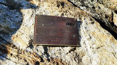
At 1550 meters of height we reach the church of Saint Anna, there is a cozy place to have a seat but the views are limited by the enclosing forest. Going up the more challenging terrain begins that will require occasional use of hands and good balance in narrow passages. At some point we reach a rocky saddle with a metal cable on the left, that indicates we have reached the place between first and second peak. To get to the first peak we need to cross the saddle, for the second (and having the cross) we scramble just a bit - the path is secured in here.
The peak with the cross in considered to be the end of the climb but actually the pain peak is 100 meters further in southern direction. Path requires attention at times. It’s worth to visit it, there are a bit better views into southern direction. Finally we can go for the fourth, southernmost one - that will mean some sharp descent and an ascent again.
Return way - most preferably the same way, can be done also descending to Hansenruhe pass. From there one can go to Waidisch but that will mean additional transport overhead or take the gravel road that runs along eastern slopes of Matzen. This is really fast way that takes us back to the flattening with a hut and set of benches. From there we know our way back.
Trip conditions
Weather:
Sunny and a bit windy, from short-sleeve feeling in the sun to dead freeze in the northern slope where water is present.
Trail:
Marked well and passable at most times. Some fallen trees in the descent from Matzen peak to Hansenruhe saddle that pose a bigger problem.
Additional information
Tips and author's comments:
If you are afraid of the ridge stopping by church of Saint Anna and going back from there is also a solution although the views are pretty limited from there.
Without snow getting to the top takes 3 hours according to the signs but moderately fit person won't take that long.
Dangers:
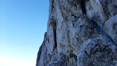
The highest section of the trip runs along the ridge, this part of the trail is marked red/black according to Austrian tourist organization. Some use of hands is required and some surefootedness will also help as the path is narrow at times. There is some protection on the way to the top of the peak with the cross but one need to be careful as it is exposed a bit.
Gear used:
trekking poles, 20l rucksack
Transportation:
Starting point reached by car, there is also bus stop pretty near-by. Parking location is showed with pin but actually you need to park on the grass stretch before it as it is a private one.
Links:Parking location
Accommodation:
No information available.