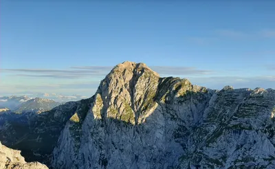
Kľak
Trip overview
This trip is not really about Kľak peak itself as there are other trails taking to it that do not require so much logistics and distance. It is more about hiking the western ridge of Great Fatra from north into southern and then western direction. It includes many other mountains on the way but Kľak is the highest of them and offers pretty abundant views in all directions.
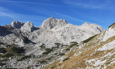
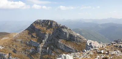
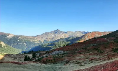
Great Fatra is often referred as the classic for trekking trips and this trip is pretty good example of that opinion. For most of the time it will be forest surrounding with meadows that once served as pastures and now making the tourist happy with great views. There is also a bit of picturesque rocks and steep sections. This particular part of Great Fatra is not really popular. Apart from the Kľak peak I met maybe 4 people for the whole trip on sunny Sunday.
Having said about quiet nature of the trip it also brings one major downside - without many people around there are sections with dense forest vegetation that makes the passage harder and requires to wade and cut through the branches.
Another problematic thing may be the transporation as it requires using at least two bus services - for the trip starting and ending point. Therefore overall attractiveness of the trip is diminished.
Trip conditions
Weather:
Sunny and warm.
Trail:
For most of the trip the path is marked with various trail colors and the path is distinct. Starting from Prislop pass dense forest vegetation makes it difficult to get through some sections as you need to squeeze yourself between young trees branches.
Additional information
Tips and author's comments:
Trip can be shortened by getting off the bus one stop earlier in Ratkovo (I wanted to see the lake therefore rode to Šútovo)
There is a more demanding variant available to ascend Lysec peak that will add some distance and about 400 meters of elevation gain. Instead of taking blue trail on Jarabiná peak just continue along main Great Fatra Trail (red color) and shortly after Maly Lysec take blue trail. From Lysec peak the yellow trail goes straight to Belá-Dulice whereas taking green trail at some point will take you to Jasenska valley (you can get some food and sleep in here)
Some of the water springs on the way were almost dry (early June) therefore I would not rely heavily upon them anymore (like I did). Found good water in locations described in links below.
Links:Earlier bus stop locationVariant through LysecWater I locationWater II location
Dangers:
Dense bushy sections and high grass increase the risk of getting tick bites.
Gear used:
20L rucksack, trekking poles
Transportation:
Car driven to Martin, left near the bus station. Bus taken from Martin bus station to Šútovo, train stop (Šútovo,žel.zast). Getting back to car - bus taken from Belá-Dulice (Belá-Dulice,,OcÚ) to Martin bus station.
Accommodation:
Best option would be to look for an overnight in Jasenska valley as there are numerous accommodation options there.