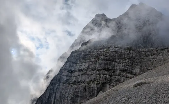
South Velebit hike-thru
Ivine Vodice hut to Struge hut
Route scheme
Trip overview
Today’s stretch will be the longest in terms of time needed for the hike, and it has the biggest ascent to cover. However, there are no accumulated single ascents and the path fluctuates at a reasonably high altitude and we never go lower than 1200 meters. We are traversing and climbing highest peaks of South Velebit. We are moved away from the coastline, landscapes are mostly mountainous. Personally for me these were resembling a bit terrain of Mala Fatra or Velka Fatra in Slovakia and the peaks have indeed even a similar height. Paths are well-trodden and devoid of that loose rock we are gonna experience in the next days. One issue here could be the bora wind; because of the altitude, it can be really nasty here.
Route description
Sveto Brdo (1.751m) from Ivine Vodice hut:
First goal for today is Sveto Brdo that is located to the east. Sveto Brdo (The Holy Mountain in Croatian) is the second-highest peak of Velebit but is widely considered the most beautiful and visually striking summit in the range. It rises sharply from the eastern side where the altitude drops rapidly. On that side, it also offers the most panoramic views. Going south-east is generally against the general direction of the trip but I would still greatly recommend climbing Sveto Brdo. The hike starts where we left off the last day, which means we are back on the steep ascent towards the main Velebit ridge, 350 meters of climb await us and we land at the opening of Čičina dolina, now taking Via Adriatica and Via Dinarica White main trail will get us to Sveto Brdo. I left my backpack in the nearby dwarf pine bushes as we need to get back here from Sveto Brdo anyway. With no stuff on my back that was about 1 hour and 15 minutes, it’s almost the same time to get back.
There is also an alternative to that steep ascent at the start - there is also a possibility to traverse the ridge a bit and first get to Vlaški Grad mountain hut - and only then to the ridge. Then you save some of that steep ascent. The trade-off is carrying the heavy backpack for a longer distance.
Links:Alternative path via Vlaški Grad shelterView from Sveto Brdo
Vaganski Vrh (1.757m) from Sveto Brdo (1.751m):
After reaching the easternmost point of the whole trip - Sveto Brdo, we are finally setting the general direction to the north-west. After leaving the entrance of Čičina dolina we traverse the south slopes of Bily Vrh (a bit of scree-like unpleasant path) to cut through the ridge and land on the north side of it. On our way, we pass the south slopes of Malovan, then Brundo and Šegestin and rise continually to the top of Vaganski Vrh - the highest peak of Velebit with 1757 meters. It offers really nice views inside the Velebit but to me views from Sveto Brdo seemed more attractive - more spacious and spectacular. Anyway, that’s the last highlight on today’s route and we will begin to lose altitude gradually to land at Struge mountain hut. What is worth mentioning is that the hut relies on the water source that is located 1km away from it - Marasovac drinking well. Luckily, that lies on our route so we can refill our water supply without the need to roam around more. That also means you need to carry more load at the end of this challenging day but the beauty of the valley it is located in will reward you greatly.
Additional information
Tips and author's comments:
In the autumn this section takes more or less whole daylight time. We filtered some water by Marasovac well which took us around 45 mins and in the last stretch to the hut we had to use the head lamps.
Accommodation:
Struge is a comfortable mountain hut with a stove and also a place for fire outside. It will sleep six people in the attic and four more downstairs. There would be also emergency space on the floor for another maybe five. There’s a table to sit at, water tanks and even a guitar (for us that was more of a curse than a blessing). It seemed to be nicely insulated because despite the frosty night outside the cold was not acute inside. Bear in mind that this is the hut with the highest altitude during the whole trip and with stable weather this is your coldest overnight stay. The hut is also located just behind a rock formation, surrounded by minor culminations making it not directly exposed to winds. One disadvantage is the lack of nearby water supply and mice that are dwelling inside the hut. There is no mobile signal in the immediate vicinity of the hut.
Provisions:
There are no water sources other than by mountain huts, so make sure to resupply in the morning so that you have enough for the whole day.
Trip photos
Other trips to check
Velika Martuljška Ponca
Mountaineering in Julian AlpsSlovenia
Cima del Vallone via Sentiero del Centenario
Scrambling/Via Ferrata in Julian AlpsItaly
Vetta Bella - Rampa Mediane
Mountaineering in Julian AlpsItaly