Hochstuhl
Trip overview
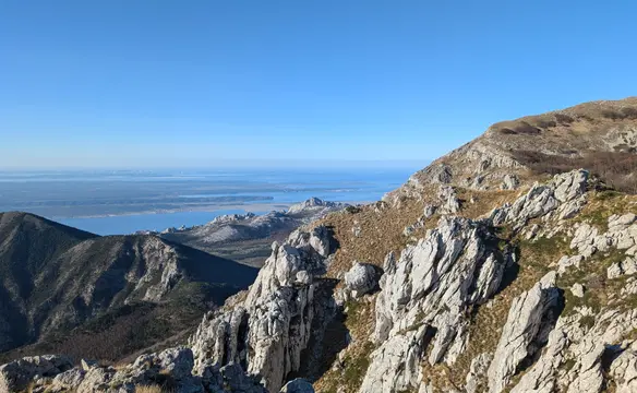
Hochstuhl, or Stol in Slovene, is the highest peak of the Karavanks range at 2.237 meters and lies on the border between Austria and Slovenia. The mountain gets its distinctive name (meaning 'high chair') from its chair-like silhouette when viewed from the east. While the southern Slovenian side offers technically straightforward hiking trails, the northern Austrian side offers vertical limestone cliffs and an interesting via ferrata climb. From the Slovenian side, the peak of Stol does not present any technical difficulties; the only challenge might be endurance because if we plan to start from the lower parking lot there is more than 1.500 meters of ascent to cover.
Hochstuhl Klettersteig via ferrata is the longest and most popular one in Karavanks, at least among the locals. Relatively short access from the parking lot and the fact it leads to the highest peak in the Karavanks range definitely contribute to that. Looking at the map, the elevation gain of this via ferrata is 600 meters, however most of this number is made up by hiking and scrambling rather than classical via ferrata climb. What is more, regarding the difficulty - although being rated as B/C, the climb is not really challenging. In reality, all the challenges await us right at the start and then ease off. That might be a good thing for rookie via ferrata climbers because the decision to retreat can be made easily without loads of downclimbing. However, for avid via ferrata climbers it could prove disappointing. Nevertheless, that's still the most ambitious way to climb Hochstuhl and really worth giving it a try.
Route description
Hochstuhl via ferrata (B/C) - access:
From one of the parking lots in Bärental valley we take the marked trail no. 603 and follow it south in the direction of Klagenfurter Hütte. First we go flat, then ascend via forest to land at the bottom of a giant scree field running from the northern walls of Hochstuhl. A bit higher up on the path running through the bushes and we get to the signpost diverting us to the via ferrata. Now we cross this scree field on a bit nasty path that takes us to the start of Hochstuhl via ferrata. It takes 60-90 minutes to get here depending on the parking lot we chose.
Hochstuhl via ferrata (B/C) - description:
| Difficulty | B/C |
|---|---|
| Access time | 1h 00m |
| Descent time | 2h 30m |
| Climbing time | 2h 00m |
| Length | 600 meters |
| Rock type | limestone |
| Wall orientation | north, north-west |
| Protection | sufficient/abundant |
Via ferrata starts under a 10m high dihedral - which is also the key stretch when it comes to difficulties. We use the steps on the right side of dihedral and then climb another two walls with metal steps (B/C). Now the climb turns left and soon we will be in a partly exposed traverse. Once it is climbed the protection is gone and we are on a hiking path. From now on the wires will appear from time to time in case of more vertical and exposed sections. The direction will change from left to right as we will be climbing to the top of this northern pillar of Hochstuhl. Once on the top, there will even be some descending, however maybe 20-30 meters maximum that will take us to a small col and land on the slopes of Hochstuhl. The route is still protected here in places till we cross a crumbly gully (wires on the left). On top of it the terrain opens up and eases off. Please reference to the photos for more details on the route.
Hochstuhl via ferrata (B/C) - exit options:
Hochstuhl via ferrata ends on the border between Austria and Slovenia. From here it's 100m of easy walk to the top of Hochstuhl. We have three options for the descent:
- Fastest - If we don't care about the peak we can descend immediately going in the direction of Weinasch peak (to the west, we turn right). We follow the marked trail running along the border and at a height of approximately 1.900 meters there is a branch off to an unmarked path back to Bärental valley - which is the fastest way to get back to the parking lots. The path runs in steep terrain and across scree fields; therefore, it is advised rather for experienced mountaineers. This is the path I have taken and which is present in GPX file you can download.
- Most popular - we get to the peak of Hochstuhl and then follow the marked trail in the direction of Bielschitza Sattel col. From there we descend on a bit nasty path to Klagenfurter Hütte and then back to the parking lot. This is the classical descent from the Hochstuhl allowing us to grab something to eat at the hut if needed.
- Most picturesque - as in option one we take the trail in the direction of Weinasch peak (which is optional to climb) and then follow the trail further to Bärensattel pass. The descent back to Bärental valley is a bit steep here, however, there are almost no crumbly rocks on the way and in good weather we will get a great view of the Julian Alps from there. Attention - this variant will work for you only if you started from lower parking, otherwise you will have to walk back up!
Trip conditions
Weather:
Since we started in the afternoon it was already stuffy and around 30 degrees, short sleeve was sufficient as far as the top and as long as we climbed up.
Trail:
Good condition of all marked trails. The via ferrata part has suffered from a landslide in one short part of about 7 meters - there is a string substitute for protection. Unmarked shortcut exit requires a lot of caution when going down and previous experience with scree field terrain.
Additional information
Tips and author's comments:
I climbed the Hochstuhl via ferrata with an 11-year-old kid and spent more time setting up a belay for him. Therefore, the estimated time for the whole thing up and down would be around 6 hours. Generally, this via ferrata can be recommended to beginner-to-intermediate via ferrata climbers. For kids it might not be the best option for their first via ferrata, as the ladders at the start are quite vertical.
Dangers:
In the upper parts of via ferrata and above it, already on the slopes of Hochstuhl, there are sections with lots of loose rock. Watch out if there are folks above you. For the descent using the shortcut - path is steep and slippery at times (little rocks). Also, experience in sliding down scree fields is necessary. When in doubt, take one of the tourist trails to get back to parking lot in the valley.
Gear used:
20l rucksack - Thule Stir 20l, helmet, harness, via ferrata set, hiking poles, approach shoes
Transportation:
Starting point reached by car. There is no bus connection to Bärental valley. There are two parking lots - lower and upper one. Asphalt road runs as far as the lower one then we need to deal with the dirt one. Doable but not recommended for cars with lower suspension and sensitive owners.
Accommodation:
There are available overnight options for both sides of the border. In Austria that will be Klagenfurter Hütte and in Slovenia - Prešernova koča na Stolu, the highest mountain hut in Karavanks.
Trip photos
Other trips to check
Raduha - Pot čez severno steno
Via Ferrata in Kamnik–Savinja AlpsSlovenia
Cima Alta di Riobianco - Spigolo Nord Integrale
Mountaineering in Julian AlpsItaly
Veunza (Della Vita, Kugy via ferrata)
Via Ferrata in Julian AlpsItaly